Startseite
Neuheiten
Kategorien
☰
Ordnance Survey
Bisher veröffentlichte Bücher des Verlags Ordnance Survey:
Ansehen
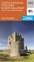
Castle Douglas, Loch Ken und New Galloway - Castle Douglas, Loch Ken and New Galloway
Survey Ordnance
OS Explorer ist die detaillierteste Karte des Ordnance Survey...
Ansehen
Newport und Pontypool / Casnewydd a Phont-Y-Pwl - Newport and Pontypool / Casnewydd a...
Survey Ordnance
OS Explorer ist die detaillierteste Karte des Ordnance...
Ansehen
Ancholme-Tal - Ancholme Valley
Survey Ordnance
OS Explorer ist die detaillierteste Karte des Ordnance Survey und wird für alle empfohlen, die Outdoor-Aktivitäten wie Wandern, Reiten und...
Ansehen
Nithsdale und Annandale, Sanquhar und Moffat - Nithsdale & Annandale, Sanquhar & Moffat
Survey Ordnance
Die OS Landranger Active Map Serie deckt Großbritannien mit...
Ansehen
Stroud, Tetbury und Malmesbury - Stroud, Tetbury and Malmesbury
Survey Ordnance
OS Explorer ist die detaillierteste Karte des Ordnance Survey und wird für alle empfohlen, die...
Ansehen
Glen Cassley und Glen Oykel - Glen Cassley and Glen Oykel
Survey Ordnance
OS Explorer ist die detaillierteste Karte des Ordnance Survey und wird für alle empfohlen, die...
Ansehen
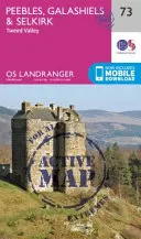
Peebles, Galashiels und Selkirk, Tweed Valley - Peebles, Galashiels & Selkirk, Tweed...
Survey Ordnance
Die OS Landranger Active Map Serie deckt Großbritannien mit...
Ansehen
Loch Morar und Mallaig - Loch Morar and Mallaig
Survey Ordnance
OS Explorer ist die detaillierteste Karte des Ordnance Survey und wird für alle empfohlen, die Outdoor-Aktivitäten wie...
Ansehen
Fort Augustus, Glen Roy und Glen Moriston - Fort Augustus, Glen Roy & Glen Moriston
Survey Ordnance
Die OS Landranger Active Map Serie deckt Großbritannien mit 204...
Ansehen
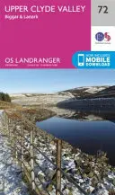
Oberes Clyde-Tal, Biggar und Lanark - Upper Clyde Valley, Biggar & Lanark
Survey Ordnance
Die OS Landranger-Kartenserie deckt Großbritannien mit 204 detaillierten Karten...
<<
9
10
11
···
51
>>