Startseite
Neuheiten
Kategorien
☰
Survey Ordnance
Bisher veröffentlichte Bücher von Survey Ordnance:
Ansehen
Glen Cassley und Glen Oykel - Glen Cassley and Glen Oykel
Ordnance Survey
OS Explorer ist die detaillierteste Karte des Ordnance Survey und wird für alle empfohlen, die...
Ansehen
Peebles, Galashiels und Selkirk, Tweed Valley - Peebles, Galashiels & Selkirk, Tweed...
Ordnance Survey
Die OS Landranger Active Map Serie deckt Großbritannien mit...
Ansehen
Loch Morar und Mallaig - Loch Morar and Mallaig
Ordnance Survey
OS Explorer ist die detaillierteste Karte des Ordnance Survey und wird für alle empfohlen, die Outdoor-Aktivitäten wie...
Ansehen
Fort Augustus, Glen Roy und Glen Moriston - Fort Augustus, Glen Roy & Glen Moriston
Ordnance Survey
Die OS Landranger Active Map Serie deckt Großbritannien mit 204...
Ansehen
Oberes Clyde-Tal, Biggar und Lanark - Upper Clyde Valley, Biggar & Lanark
Ordnance Survey
Die OS Landranger-Kartenserie deckt Großbritannien mit 204 detaillierten Karten...
Ansehen
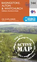
Basingstoke, Alton und Whitchurch - Basingstoke, Alton and Whitchurch
Ordnance Survey
OS Explorer ist die detaillierteste Karte des Ordnance Survey und wird für alle...
Ansehen
Huntingdon und St. Ives, Grafham Water - Huntingdon and St.Ives, Grafham Water
Ordnance Survey
Die unverzichtbare Karte für Outdoor-Aktivitäten in Huntingdon, St. Ives...
Ansehen
Vale of Clwyd, Rhyl, Denbigh und Ruthin - Vale of Clwyd, Rhyl, Denbigh and Ruthin
Ordnance Survey
Die unverzichtbare Karte für Outdoor-Aktivitäten im Vale of Clwyd,...
Ansehen
St. Austell, Liskeard, Fowey, Looe und Lostwithiel - St.Austell,Liskeard, Fowey, Looe and...
Ordnance Survey
OS Explorer ist die detaillierteste Karte des...
Ansehen
Nuneaton und Tamworth - Nuneaton and Tamworth
Ordnance Survey
OS Explorer ist die detaillierteste Karte des Ordnance Survey und wird für alle empfohlen, die Outdoor-Aktivitäten wie...
<<
8
9
10
···
31
>>